Main menu
You are here
Tracking and recovering weather balloons -- An Update
by Ralph Adams, VA7VZA
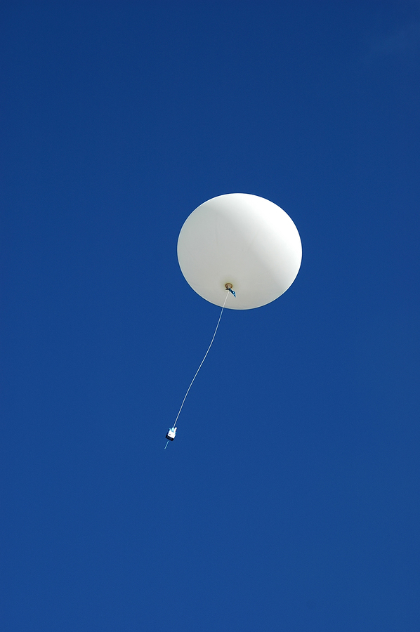
Back in October, I described what weather balloons and radio-sondes were and how it was possible to track them (https://karc.ca/node/569). Since then, I have made some interesting progress and discoveries. Here is a short update about how far I have come towards my goal of retrieving a radio-sonde after it has fallen back to earth. As you would expect, there is good news and bad. The good news is that it is relatively easy to track them using simple equipment, but the bad news is that all the balloons launched from Vernon that I have tracked have headed off to the East or South. The only real question each day has been, which inaccessible mountain range will it fall on: the Monashees, the Selkirks, or the Rockies!
THE SETUP TO TRACK WEATHER BALLOONS
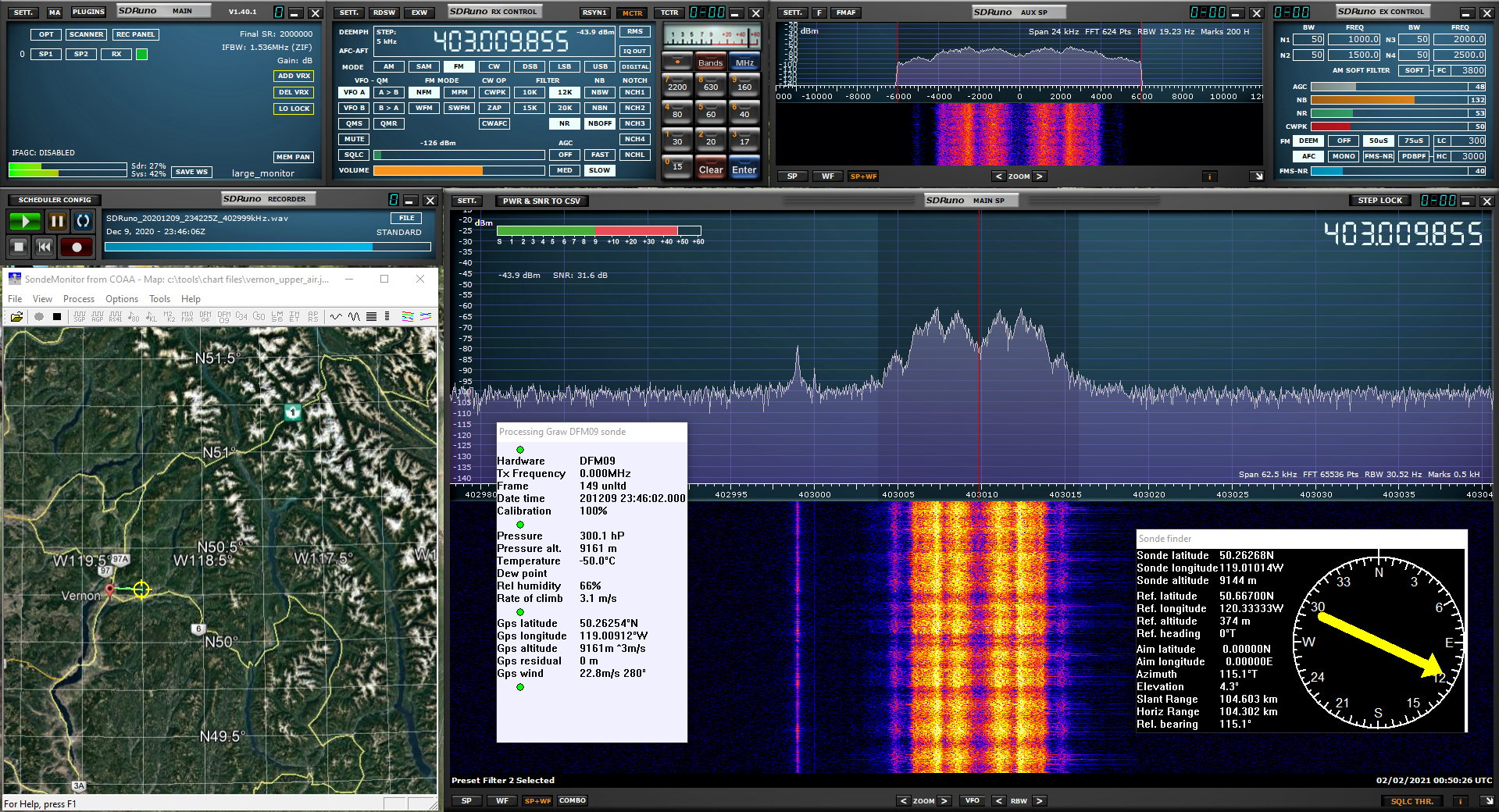
Myles, VE7FSR was first in to assist by giving me a Sinclair 7-element Yagi for 406 to 433 MHz. A check with the Rigmaster showed that it worked well at 403 MHz where the radio-sondes transmit. I mounted it on a short PVC mast attached to a camera tripod, the antenna is at about 1.8m and is oriented for vertical polarization. Feedline is a two metre length of LMR-195 from the junk-box that happened to have a good UHF connector at one end and an SMA at the other. The receiver is an SDRPlay RSP1a (links are included at the end of this article) connected to an old Lenovo ThinkPad. I use the SDRUno software supplied by SDRPlay. One advantage of an SDR (Software Defined Radio) is that you can record the IQ spectrum which can be replayed and reprocessed later. I am using an old Western Digital USB drive to store the recordings, which are large, about half a GB per minute of spectrum recording. The whole system is powered by the internal laptop battery.
SDRUno was setup to use a bandwidth of 15kHz and FM mode, and the demodulated audio was piped into the decoding software using Virtual Audio Cable. For the first attempts I was not sure which radio-sondes were being used by Environment Canada (EC), so I decided not to purchase decoding software yet. After I had some radio-sonde recordings from the Vernon launches I was able to confirm that the radio-sonde being used is the Graw DFM09 manufactured in Germany. I then purchased the SondeMonitor software (24 Euros) which can decode the DFM09 telemetry.
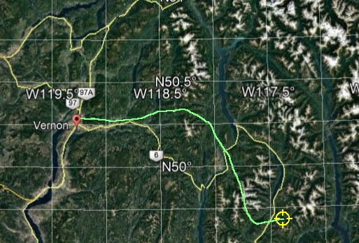
For the first attempt I thought I would not drive all the way to Vernon, but would first try from a good vantage point near Kamloops, so I found a place on Rose Hill Road with good exposure to the East and South and set up one afternoon in November. I set the system up in the back of the SUV and pointed the antenna toward Vernon. The ascents are done twice a day at 0:00 and 12:00 UTC, but the launches occur shortly before that time. I started monitoring at 15:15 local or 23:15 UTC. I could not see any signals near 403 MHz, by 15:30 nothing had happened, except that it started to snow, and the wind had come up. My vehicle, the antenna, and I, all started to rime up on the east side. About then a vehicle pulled over to where I was parked and I went over and explained what I was doing, the driver smiled, shook his head, and then drove away. At around 15:45, just about the time I was thinking that this was a very silly idea, the signal appeared on the waterfall display. It did not slowly increase like the signals from satellites as they come over the horizon, it went from nothing to a strong clear signal in seconds. Later, after I had purchased the decoding software and reprocessed the recording, I found that the signals appear when the balloon was around 5km in altitude, meaning it had been launched earlier than 15:45. I assume this is due to the effective horizon 100km away and the fact that the radio-sonde transmits with a power of 100mW so I can only receive the signal when the radio-sonde is above the effective horizon caused by the topography between Rose Hill Road and the radio-sonde, and the curvature of the earth. I monitored the signal until 17:30 when the weather just got too bad, and snow drifts were forming around the laptop and RSP1a. Later when I processed that first recording, I found that the radio-sonde was at an elevation of 25km and East of Arrow Lake when I had packed up.
Since then I have tracked a dozen or so of the Vernon 0:00 UTC launches. I was joined one afternoon by Doug, VA7GPX. Keeping with the weather theme, that day there was heavy fog blanketing Rose Hill Road. This led to a rather bizarre exchange on the Lolo repeater that some of you may have heard as we tried to find each other, "Doug, did you just shut your car door .... I can hear you, but I can't see you." Turns out we were less than 50m apart but could not see each other in the dense fog. Driving back down Rose Hill Road a few hours later in the dark was also rather entertaining.
WHAT I HAVE FOUND SO FAR
Based on the launches I have tracked this is what I have discovered:
- The radio-sondes launched from Vernon are the Graw SDM09, or more precisely, they can be decoded using the SDM09 software.
- Signals can be easily received from a high vantage point in Kamloops for distances up to 350km when the radio-sonde is at higher altitudes.
- Radio-sondes are launched from Vernon before 0:00 UTC and by the time I can acquire the signal on Rose Hill Road, have reached 4 to 5 km in altitude. The signal usually appears between 3:30 and 3:45 PST.
- The SondeMonitor software can decode the telemetry during the ascent and give altitude, windspeed, wind direction and GPS location. The GPS location can be shown on a map in real time. The software also supplies a heading and elevation angle which can be used to adjust the antenna. Unfortunately, the software cannot correctly decode the temperature and humidity data for this type of radio-sonde.
- The balloons carrying the radio-sondes burst at an altitude between 34 and 36 km. The radio-sondes do not appear to use parachutes to slow descent. Initial fall rate is 20 to 30 metres per second (compared to a rise rate of 3 to 7 metres per second).
- The signal does not change in strength as the radio-sonde falls, which suggests that the balloon tatters are acting as a drogue-chute. If the radio-sonde was tumbling as it fell, I would expect the signal strength to fluctuate due to the orientation of the antenna changing. During some ascents, the signal did fluctuate for a few seconds immediately after the balloon burst.
- In all the ascents I have tracked so far, I have lost the signal when the radio-sonde is falling, but still well above the ground. Usually 11 to 15km in altitude. By then the radio-sonde is 200 to 300km from my receiving location. I assume this is due to the radio-sonde falling below the effective horizon, but it could also indicate that the radio-sonde stops transmitting either due to a timer being activated or the batteries failing. I think this unlikely as the time from launch is variable. If it were due to the batteries failing or a timer, there will be no chance of recovering a radio-sonde as you need to track it all the way to the surface.
- In all the ascents that I have tracked the radio-sonde would have landed in the Monashees, the Selkirks, or the Rockies. In other words, the track has been to the East or SE and the radio-sonde has travelled a large distance.
BUT THERE IS STILL HOPE
While I have yet to track a radio-sonde that I could recover, I am not giving up yet. The US weather service (NOAA) has written software which they distribute freely that estimates radio-sonde tracks based on modelled windspeeds and assumed radio-sonde characteristics such as ascent rate, burst height, and fall rate (which I can estimate for the Vernon radio-sondes based on the ascents I have tracked).
Because the software uses modelled windspeed data which are archived, you can run simulations of past ascents for any location or time. Based on comparing the tracks I have recorded and the modelled tracks of the same launches, the software is not good enough to recover the radio-sonde but does a good job of indicating in which general direction the radio-sonde will travel. Using the model and archived windspeeds, I have been looking back in time to see if any balloons landed in accessible locations. They have! Under some weather conditions several them have landed in the North Okanagan or the Shuswap. Also, some of the radio-sondes launched from Prince George make it as far as the Cariboo; those launched from Port Hardy all seem to end up in the Coast Mountains.When the weather improves and the days get longer, I shall start checking the predicted paths of future launches and if one looks promising I will drive to a location near the predicted landing site and track the radio-sonde that afternoon. Assuming I am in the same valley system, I should be able to receive the radio-sonde signal until the landing and figure out where that is.
ODDS AND ENDS
While waiting for the weather to improve there are a couple of other weather balloon projects I have found: the Mysondy project which repurposes inexpensive ESP32 LoRa boards to track radio-sondes, and a project to automate the tracking of weather balloons and radio-sondes.
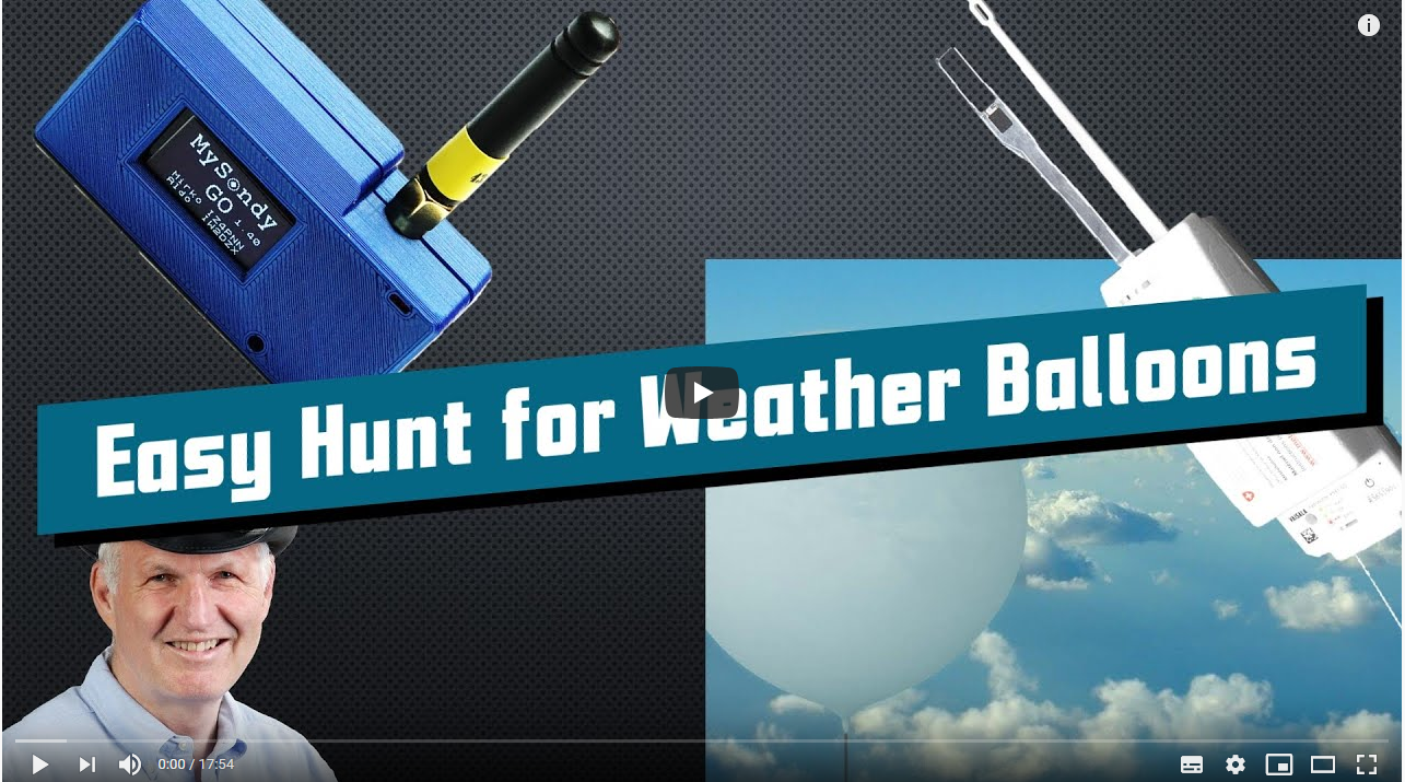
LoRa (Lo-ng Ra-nge) is a proprietary spread spectrum system that implements a network that is often used for IoT or similar applications when local WIFI is not available. There are many implementations and the boards are often based on the ESP32 microprocessor and are very inexpensive. In North America the frequency used is 915MHz and in Europe it is 868MHz, however, in some places 433MHz is used. A group of enthusiasts in Italy have discovered that the 433MHz boards can be modified by replacing the antenna and using custom software to make small hand-held radio-sonde trackers. One thing I have not been able to determine is if this is legal in Canada given that LoRa boards can transmit as well as receive. Also, the instructions are in Italian! They do work, Andreas Spiess "the guy with the Swiss accent" has a very entertaining video on his YouTube channel where he builds one and recovers a radio-sonde using one. Something like this would be very useful if I ever get to the point where I'm tracking radio-sondes on foot.
Radiosonde auto-rx is an open-source project that uses a Raspberry-Pi, an SDR dongle, and an antenna to automatically receive and decode radio-sondes. Using various bits of opensource code the spectrum used by the radio-sondes is scanned and if a signal is detected it is decoded and the radio-sonde track data uploaded to a site that can show all the radio-sondes being tracked in real time.
LINKS
SDRPlay, RSP1a and SDRUno: https://www.sdrplay.com/
SondeMonitor Software: https://www.coaa.co.uk/sondemonitor.htm
NOAA balloon track prediction software: https://www.esrl.noaa.gov/gmd/ozwv/wvap/sw.html
Mysondy project: https://www.rtl-sdr.com/mysondy-radiosonde-tracking-firmware-for-a-ttgo-esp32-lora-board/
This is an article on the RTL-SDR site about the project. Check out some of the other articles, the scope of the projects that people are using these very inexpensive RTL-dongles for is amazing. Perhaps this is the future of amateur radio?


